
10-Day In-depth Pure Play Tour of the Exotic Southern Xinjiang Loop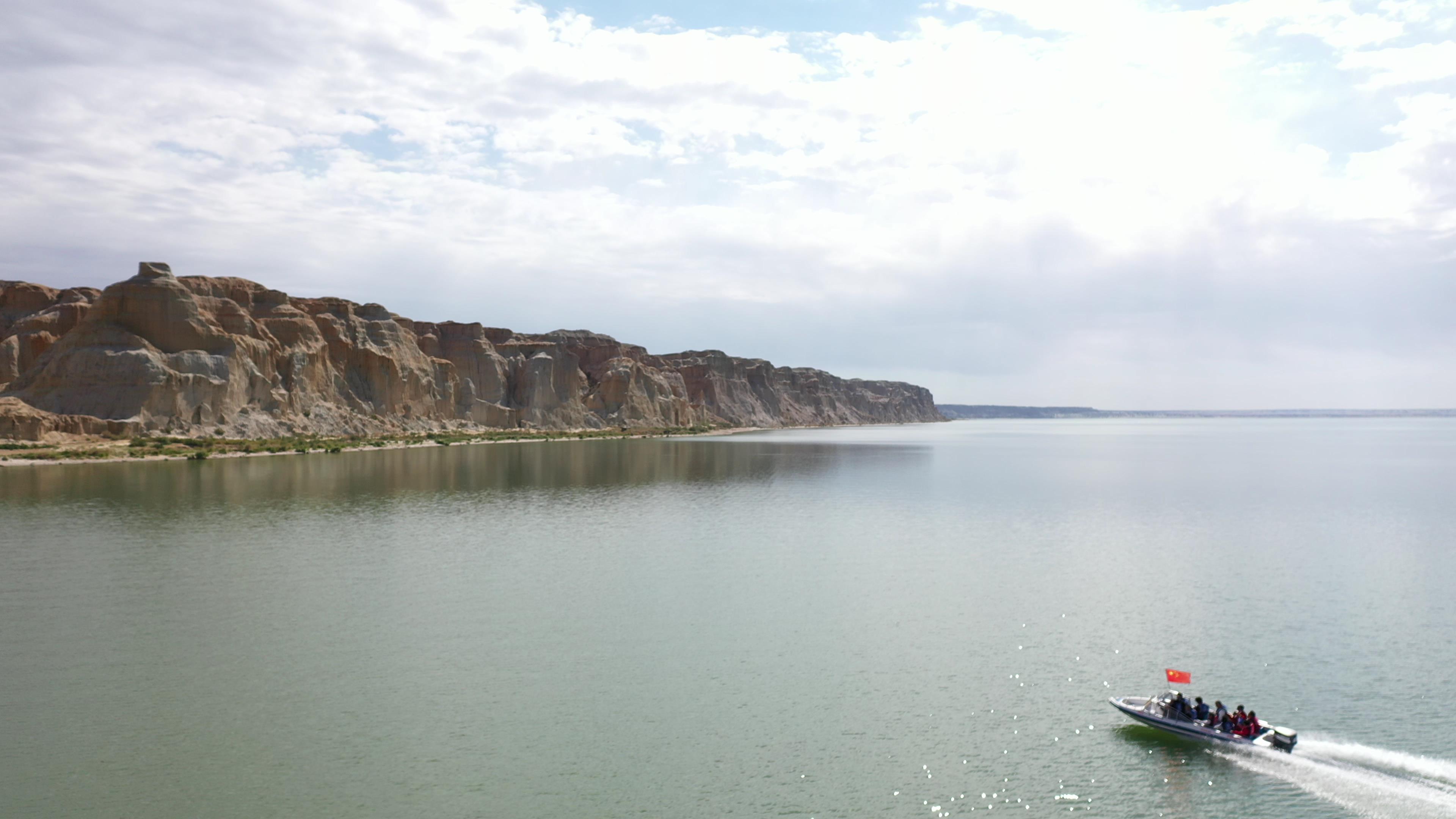

Xinjiang Tourism Consultation: (Same) 0991-8585456
D1: Kashi Gathering
As a key transportation hub on the ancient "Silk Road", Kashi has always been an international market where Chinese and foreign merchants gather and a place where Eastern and Western cultures converge.
Kashi City, belonging to Kashi Prefecture in Xinjiang Uyghur Autonomous Region, is located in the southwestern edge of Xinjiang, in the west of the Tarim Basin. It borders the Taklamakan Desert to the east, the Karakoram Mountains and Tibet’s Ali Region to the south, and the Pamir Plateau to the west. It is a border city in the westernmost part of China.
D2: Kashgar – Atush Heavenly Gate – Kashgar Old City – Grand Bazaar – Gaotai Residential Area – Kashgar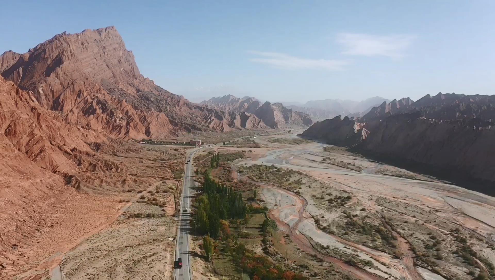
The old city of Kashgar feels like stepping into a vivid picture scroll of Uyghur folklore in Xinjiang. The old city of Kashgar is located in the center of Kashgar City, covering an area of 4.25 square kilometers with a population of about 126,800 residents. The streets and alleys of the old city are crisscrossed and flexibly laid out, with winding paths leading to secluded spots. Most of the residences are made of earth, wood, and brick, and many traditional residences have a history of over a hundred years. It is the only maze-like urban block in China that features cultural characteristics. The Atush Heavenly Gate is an AA-level tourist attraction located in the southern branch of the Western Tianshan Mountains, in the western part of Shangatush Town, Atush City, 75 kilometers from Atush City. The Heavenly Gate forms a "π" shape, with a width of about 100 meters and a height of over 500 meters. Its thickness is immeasurable. This scenic spot is magnificent, steep, deep, quiet, and mysterious. The surface of the stone wall resembles a variety of strange murals.
Kashgar Grand Bazaar, also known as the Central and West Asia International Trade Market, is located on the east bank of the Tumang River in the northeast corner of Kashgar City, also known as the East Gate Grand Bazaar. It covers an area of 250 mu (a traditional Chinese unit of area), with 21 specialized markets inside. It is the largest international trade market in the northwest of China.
D3: Kashgar – Baisha Lake – Muztagh Ata – Karakuli Lake – Kashgar
Known as the "Black Lake", Karakuli Lake offers views of the southern Xinjiang Uyghur rural countryside along the way, allowing you to feel the leisurely and contented atmosphere of Jiangnan (a region in southern China) in the depths of the desert. You can take in a distant view of Aoyitake Hongshan, known as the "Flaming Mountain of Southern Xinjiang", and also take photos in front of Baisha River, known as the "River of Quicksand", and布伦口 White Sand Mountain, which is a masterpiece of nature’s craftsmanship. Occasionally, ancient post stations of the Silk Road can also be seen along the way. Get up close to admire the 7,546-meter-high Muztagh Ata, the Father of Glaciers, and the ever-changing colored plateau lake, Karakuli Lake. The reflection of Muztagh Ata on the surface of Karakuli Lake, the majestic appearance of Kongur Tagh at 7,719 meters above sea level, herdsmen driving yak herds, and you can also ride horses or camels at your own expense for photos.
"Muztagh" means "ice" in Uyghur, "Tagh" means mountain peak, and "Ata" means father. The Tajik and Kyrgyz people who live at the foot of the snowy mountains affectionately call the Muztagh Ata as the "Father of Glaciers".
D4: Kashgar – Zepu Golden Poplar Forest – Yarkand
Zepu Golden Poplar Forest, the Golden Poplar National Forest Park is located in the Yasidun Forest Farm territory, 36 kilometers southwest of Zepu County. It sits on the upper edge of the Yarkant River alluvial fan. The scenic area covers an area of 40,000 mu (a traditional Chinese unit of area, approximately 666.67 square meters per mu), with a natural poplar forest area of up to 20,000 mu. In the distance, the mighty Kunlun Mountains loom, and at your feet, the tributaries of the Yarkant River rush ceaselessly, crossing through the park. The snowy Kunlun Mountains and the Yarkant River jointly nurtured this magical land. The Golden Poplar National Forest Park boasts diverse vegetation types, with a continuous natural forest of 489 hectares and a forest coverage rate of 76%. There are a total of 51 species of plants belonging to 39 genera and 27 families, including a large number of medicinal plants such as licorice, seaberry, wolfberry, dodder, ephedra, and datura. Red willow and the precious medicinal material Cistanche deserticola, known as the "ginseng of the desert", which grows attached to the red willow, can be seen everywhere. There are also rare and delicious poplar mushrooms.
Zepu Golden Poplar National Forest Park, a national 5A-level tourist attraction, is located in Yasidun Forest Farm, 40 kilometers southwest of Zepu County. It is nestled on the upper edge of the Yarkand River alluvial fan and surrounded by water on three sides, offering delightful scenery.
D5: Yarkant – Pick Jade in Yulong River, Kashgar – Hotan
Pick jade in Yutian River, Kashgar, and then arrive in Hotan City, where the rich Uyghur culture is evident. Hotan jade, handmade carpets, Aidelais silk Bazaar, piles of fiery red pomegranates, sweet grapes and melons, exotic charcoal-grilled eggs, delicious tandoori pumpkin, and beautiful Uyghur girls make it a place hard to forget. Afterward, visit the Yulongkashi River. The Yulongkashi River and the Karakashi River originate from Mount Kunlun and converge deep in the desert to form the Hotan River, which eventually flows north into the Tarim River. In the evening, Hotan’s night food stalls are a must-visit.
D6: Hotan – Desert Highway – Aksu
Driving on the world’s longest desert highway, we traverse the Taklamakan Desert, the world’s second-largest desert known as the "Sea of Death". The miraculous desert highway, stretching across thousands of miles of sandy expanse, sand dunes, poplar trees, and tamarisks is breathtaking. Upon arriving in Aksu City, we are greeted by its rich Uyghur culture. Aksu has a pleasant climate, flat terrain, fertile land, abundant water resources, sufficient sunshine, and a long frost-free period, making it suitable for growing various crops. The city has 780,000 mu of arable land, 700,000 mu of forest, and 4,030,000 mu of grassland, allowing for grazing throughout the year. It is an important national base for commodity grain and cotton. Its specialty products such as red dates, thin-skinned walnuts, Red Fuji apples, apricots, fragrant pears, grapes, and melons enjoy a high reputation domestically and internationally, making it famous for its fruits.
China’s Xinjiang Taklamakan Desert Highway (also known as the Tarim Desert Highway): It is currently the world’s longest graded highway crossing a shifting desert and is also China’s earliest desert highway.
D7: Aksu – Mysterious Grand Canyon of Tianshan – Kuqa
Kuqa Grand Canyon, one of China’s most beautiful canyons and a national geological park, is a world wonder. The Mysterious Grand Canyon of Tianshan is located in the Keziliya Mountains at the southern foot of Mount Tianshan. With red mountains, steep slopes, and deep, long valleys, it is as wide as a square in some places and only wide enough for one person to pass in others. With winding paths and echoing sounds, standing on the mountain peak allows you to fully appreciate its charm of being mystical, magical, majestic, ancient, and serene. Afterward, drive to Kuqa for accommodation.
Kuqa Grand Canyon is located at the southern foot of Mount Tianshan, 80 kilometers north of Kuqa County. In Uyghur, it is called "Kezilya", meaning "red cliff". With an altitude of over 2,800 meters and stretching east-west, it is a 50-meter-deep and 5-kilometer-long ground fissure formed by the melting water of Mount Tianshan. It is known as the "Mysterious Grand Canyon" and "Devil Canyon". Kuqa Grand Canyon is one of China’s top ten most beautiful canyons and has been listed as a national geological park.
D8: Kuqa – Tarim Hu Yanglin – Korla
Tarim Hu Yanglin National Forest Park covers a total area of 100 square kilometers and is located 70 kilometers away from the desert highway south of Luntai County, Bayingolin Mongolian Autonomous Prefecture, in the middle reaches of the Tarim River on the northeastern edge of the Taklamakan Desert. It is the largest primitive Hu Yanglin forest park in Xinjiang and also the area with the most concentrated primitive Hu Yanglin in the entire Tarim River basin. Tarim Hu Yanglin National Forest Park integrates Tarim River natural landscapes, Hu Yanglin landscapes, and desert landscapes. It is the oldest, largest, best-preserved, and most primitive Hu Yanglin reserve in the world. Hu Yanglin is a relic tree species from the third century AD, a plant transformed due to desertification. Its rarity is comparable to that of ginkgo, and it has strong vitality, earning it the name "living fossil".
Tarim Hu Yanglin National Forest Park covers a total area of 100 square kilometers and is located 70 kilometers away from the desert highway south of Luntai County, Bayingolin Mongolian Autonomous Prefecture, in the middle reaches of the Tarim River on the northeastern edge of the Taklamakan Desert. It is the largest primitive Hu Yanglin (Populus euphratica) forest park in Xinjiang.
D9: Korla – Lop Nur Village – Heshuo
Lop Nur Village covers an area of 72 square kilometers and is home to more than 20 households, making it one of the largest villages in western China. It belongs to Qiongkule Ranch and is a utopia inhabited by Lop people. The road leading to the village is built on the Gobi Desert, exuding a sense of desolation. Upon arriving at the village gate, the bustling and noisy city atmosphere completely disappears. The gate, made entirely of wood, is also known as the "Gate of Longevity," and its design has historical origins. Inside the village are houses built with wood or thatched grass. The houses are not clustered together but rather scattered. Around the houses are toys left by Lop children, such as wooden horses and swings, in their most primitive forms. The structures of the houses are also completely different, giving people a sense of casualness.
The Lop Nur Village is located 35 kilometers southwest of Yuli County, Xinjiang, covering an overall area of 72 square kilometers and home to only more than 20 households. It is one of the largest villages in China and a once-isolated utopia.
D10: Heshuo – Monster Stone Forest – Urumqi – Home
The Toksun Pangjier Monster Stone Forest is such an extraordinary mountain. Its beauty and uniqueness will be etched in the hearts of those who have seen it, making it unforgettable. The Pangjier Monster Stone Forest is scattered across the ridges and slopes of Mount Pangjiertage, with an average altitude of 1,200 meters and a total area of about 1 square kilometer. The stone forest is located 55 kilometers southeast of Toksun County and 10 kilometers from Kerjian Town. Formed by dissolution and wind erosion, the stone forest is known as "Pangjiertage", which means "mountain with porous windows" in Uyghur.
The Pangjier Monster Stone Forest in Xinjiang has only attracted attention in recent years as a tourist attraction. The Yardang landform is a masterpiece created by the wind, and the Pangjier Monster Stone Forest can be considered the masterpiece among Yardang landforms.
Xinjiang Tourism Consultation: (Same) 0991-8585456