
Xinjiang Tourism, Xinjiang tourist routes for National Day holiday
How to travel in Xinjiang? Here are some routes for you
Xinjiang Tourism Consultation: (Same) 0991-8585456
To Xinjiang
Require special courage to bear
The magnificent deserts, the primeval Gobi deserts,
The tenderness of meadows, the killing intent of glaciers,
The openness of canyons, the entanglement of forests,
The sternness of glaciers, and the civilization lost on the wilderness
10 best routes to Xinjiang in the second half of the year
The Northern and Southern Xinjiang Loop Route
▌ Route Overview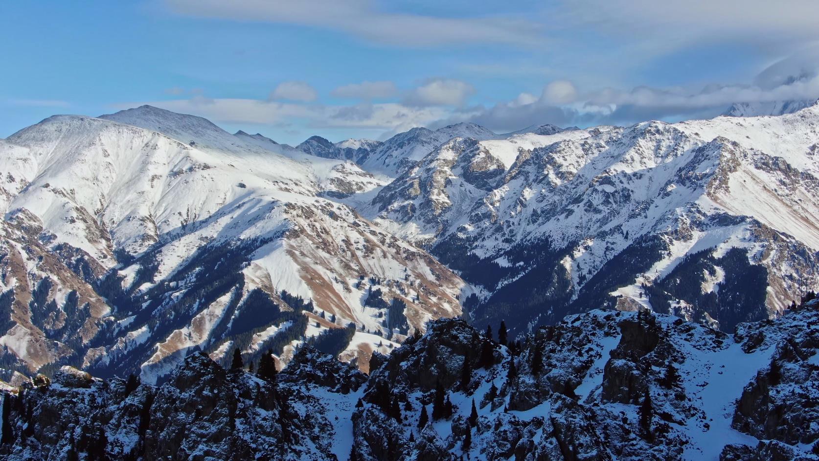

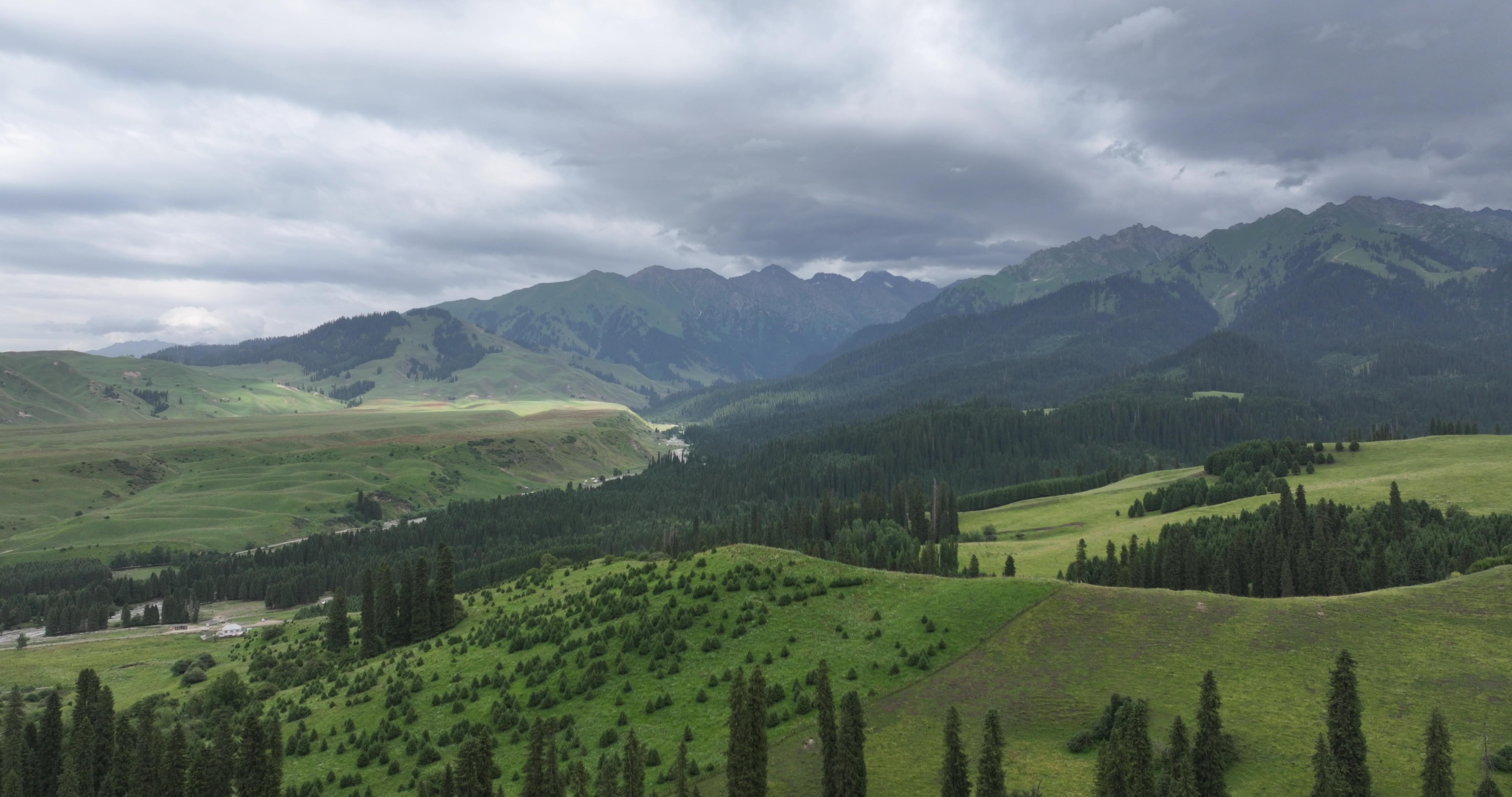
The route first circles around the Junggar Basin, then enters the Jiangnan-like region beyond the Great Wall in Xinjiang – the Ili Valley, reaching the Bayanbulak Grassland in the hinterland of the Tianshan Mountains, crossing over mountain passes and passing through the Gobi Desert, stepping into the folk-custom-rich Turpan Basin, and finally returning to Urumqi. The entire journey lasts for 11 days and covers nearly 4,000 kilometers, crossing the Gobi Desert (General Gobi), spanning the desert (Gurbantünggüt Desert), climbing snow-capped mountains (Tianshan Mountains), and galloping across grasslands (Nalati and Bayanbulak Grasslands).
Northern Xinjiang, the Junggar Basin, the Ili Valley, the Tianshan Mountains, the Altai Mountains, these are all regions full of legendary colors yet little known to the public. For thousands of years, the Saka people, the Dayuezhi people, the Wusun people, and the Mongols have written the epic songs of history with their iron-clad horses and spears.
Urumqi – Tianchi – Colorful City – Jiadenyu – Kanas – Hemu – Urho – Sayram Lake – Yining – Nalati – Bayanbulak – Hejing – Shanshan – Urumqi
D1 Urumqi – Tianchi – Colorful City
D2 Colorful City – Burqin
D3 Burqin – Jiadenyu – Kanas
D4 Kanas – Hemu
D5 Hemu – Urho
D6 Urho – Sayram Lake
D7 Sayram Lake – Yining – Nalati
D8 Nalati – Bayanbulak
D9 Bayanbulak – Hejing
D10 Hejing – Shanshan Kumtag Desert
D11 Shanshan – Urumqi
2
Lop Nur Traverse
Traverse the Sea of Death in China – Lop Nur, follow the ancient Silk Road to seek out the ancient kingdom of Loulan from 3,000 years ago, come into close contact with Loulan beauties, and feel the desolation and awe-inspiring historical culture of the Silk Road. There is a possibility of close encounters with wild camels, a national first-class protected wild animal. Follow in the footsteps of explorers and experience the charm of the Gobi Desert.
With a wave of time, the sea turned into a desert. The once bustling fishing boats at dusk are now only represented by a few river traces; yesterday’s lush pastures with grazing cattle and sheep have turned into vast stretches of sand. Heroes once conquered beauties and rode away, leaving piles of gold coins and jade pendants behind, until the last wisp of lonely smoke disappeared into the horizon.
Urumqi – Da Haidao – Ancient River Course – White Dragon Dunes – Lop Nur Town – Colored Stone Beach – Ancient Milan City – Qiemo – Yatonggusi Ancient City – Andier Township – Yatonggusi Ancient City – Taklamakan Desert – Huyang Forest in Luntai – Korla – Urumqi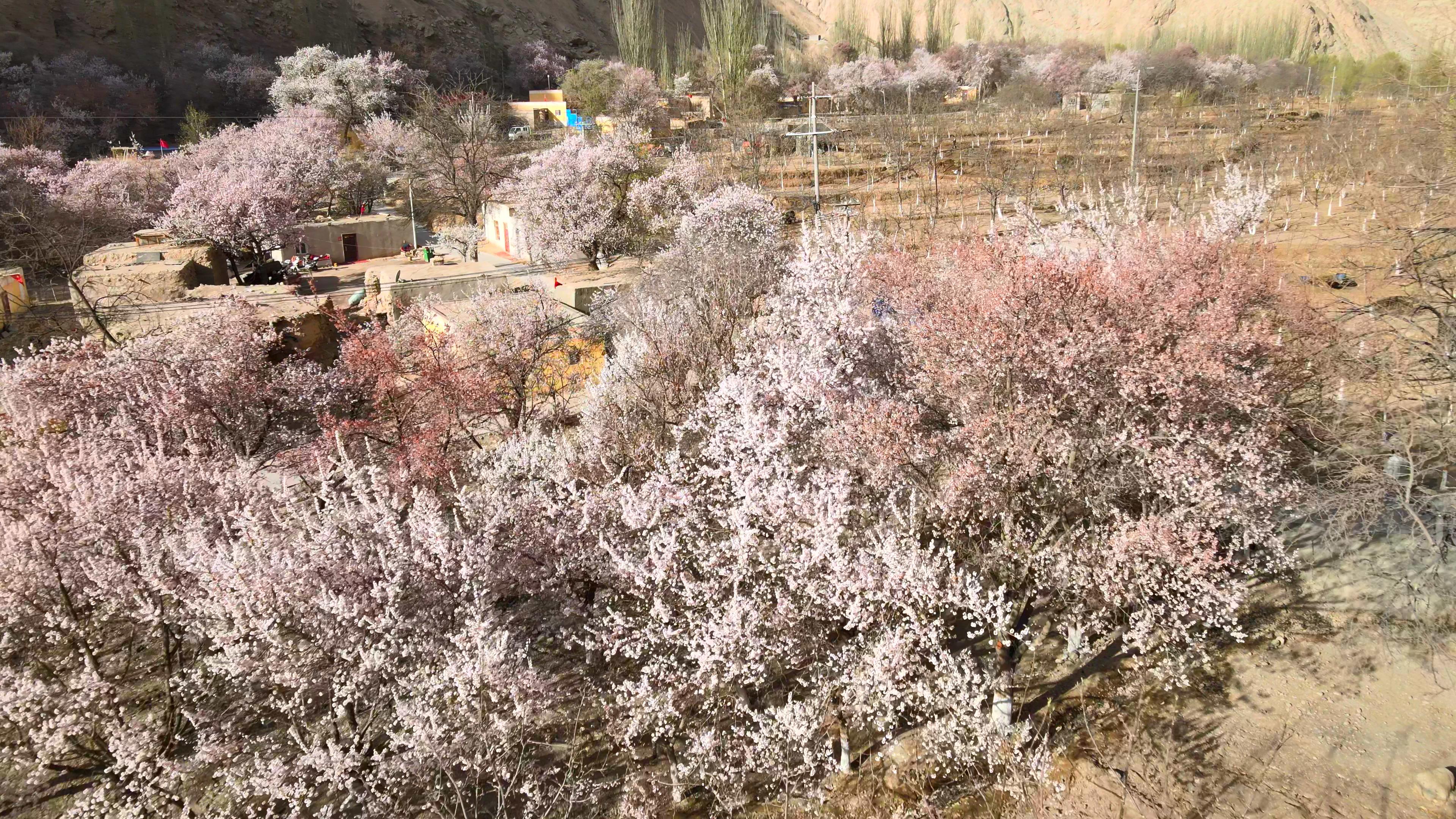
D1 Urumqi – Dahaidao
D2 Dahaidao – Ancient River Course
D3 Ancient River Course – White Dragon Heap – Lop Nur Town
D4 Lop Nur Town – Colorful Stone Beach – Milan Ancient City
D5 Milan Ancient City – Qiemu – Yatonggusi Ancient City
D6 Andier Town – Yatonggusi Ancient City – Taklamakan Desert
D7 Taklamakan Desert – Luntai Populus Forest – Korla
D8 Korla – Urumqi
Kanas East-West Grand Loop
▌ Route Overview
Kanas is located in the middle of the Altay Mountains in northern Xinjiang, in the golden zone bordering Kazakhstan, Russia, and Mongolia. Its natural and cultural landscapes have always maintained their primitive appearance and are known as the ‘Pure Land on Earth’. Kanas Lake is known as the ‘Most Beautiful Lake in the World’.
The four seasons change with colorful scenery, and there are quiet and peaceful ancient villages. Ride a horse along the ancient horse trails to gallop on the grasslands, listening to the wind whistling in your ears; see snow-capped peaks surrounding the mountains, flowers everywhere, and eagles soaring above; walk on flowers to seek out uninhabited secret spots; pitch a tent under a starry sky, light a bonfire, and sing those ancient ballads; when you look up at the peaceful starry sky, the mundane world is far away on the other side of the globe.
▌ Brief Itinerary
Urumqi – Habahe County – Baihaba – Naren Pasture – Shuanghu – Tielisahan Pasture – Kanas – Xiaohei Lake – Hemu – Burjin – Beitun – Urumqi
D1 Urumqi – Habahe County (Sleeper Bus)
D2 Habahe – Baihaba (Wooden Hut, Car)
D3 Baihaba – Naren Pasture (Camping, Light Hiking)
D4 Naren Pasture – Shuanghu (Camping, Light Hiking)
D5 Shuanghu – Tielisahan Pasture (Camping, Light Hiking)
D6 Tielisahan Pasture – Kanas (Wooden Hut, Light Hiking)
D7 Kanas (Wooden Hut, Light Hiking)
D8 Kanas – Xiaohei Lake (Camping)
D9 Xiaohei Lake – Hemu (Wooden Hut, Light Hiking, Public Bathroom)
D10 Hemu (Wooden Hut, Public Bathroom)
D11 Hemu – Burjin – Beitun (Car)
D12 Beitun – Urumqi (Train or sleeper bus)
Xinjiang Tourism Consultation: (Same) 0991-8585456