
The correct way to travel to southern Xinjiang
Unlike the picturesque green mountains and rivers of northern Xinjiang, the natural scenery of southern Xinjiang is more magnificent and rugged
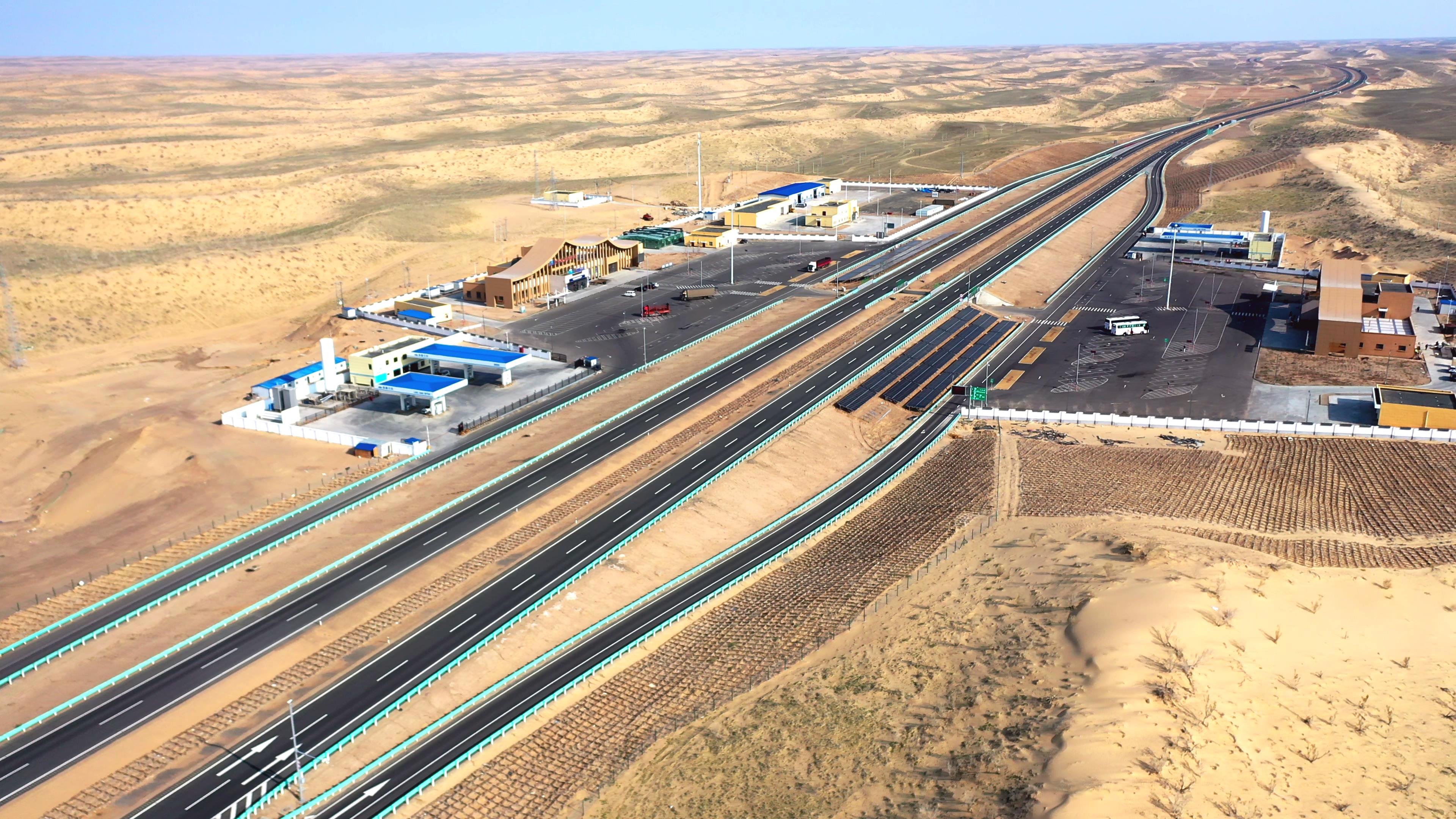
Taklamakan Desert
Two desert highways cross the land of southern Xinjiang, bringing the Taklamakan Desert into the eyes of the world. Crossing it, one can feel the ruggedness and heroism of traversing the uninhabited desert. If it happens to be autumn, the golden desert poplars accompanying you will add a unique vitality to this desert.
Pamir Plateau
Karakul Lake is located at the foot of Mount Mushtag. ‘Karakul’ means ‘black sea’, and it is an alpine glacial lake. The majestic and mysterious Mount Mushtag is reflected on the water surface, covered in snow, with the mountains and water sharing the same color, creating a very charming scenery.
Stone City in Tashkurgan County
The Stone City in Tashkurgan County is the intersection of the middle and southern routes of the ancient Silk Road. The castle is built on a high hill, with an extremely steep terrain. Multiple layers of continuous or discontinuous city walls are built outside the city, with stone hills overlapping and piles of rubble between the walls, forming a unique scenery of the Stone City.

Kizil Thousand Buddha Caves
Southern Xinjiang was a necessary passage on the ancient Silk Road. The prosperity of the Silk Road at that time can be seen from the scattered ancient cities, Buddhist temples, and beacon towers in various places in southern Xinjiang. The murals in Kizil Thousand Buddha Caves are influenced by Han culture and also cleverly accept foreign culture and art with selectivity, demonstrating the extraordinary wisdom of ancient Kucha painters.
Old City of Kashgar
How to arrange the itinerary?
D0: Gather at the designated hotel in Urumqi from all over the country
Team members who arrive in Urumqi in advance can visit the Xinjiang Museum to gain a preliminary understanding of Xinjiang’s history and culture, or go to Erdaoqiao International Bazaar to explore the specialty markets and taste local cuisine
D1: Urumqi – Luntai County
Embark on the journey of the Silk Road in southern Xinjiang in the morning sun, heading south along National Highway 314, crossing the Tianshan Mountains from northern Xinjiang into the Tarim Basin in southern Xinjiang, with the magnificent Tianshan Mountains along the way
Driving Distance: 650 km
D2: Luntai County – Tazhong
After breakfast, we depart from Luntai County and travel south on the desert highway, entering China’s largest desert, the Taklamakan Desert. Along the way, we visit the Populus euphratica Forest Park and the Tarim River. In the afternoon, we arrive early at our accommodation in the heart of the Tazhong Desert. The guide leads everyone to watch the sunset together and take photos in the desert.
Driving Distance: 340 km
D3: Tazhong – Yutian County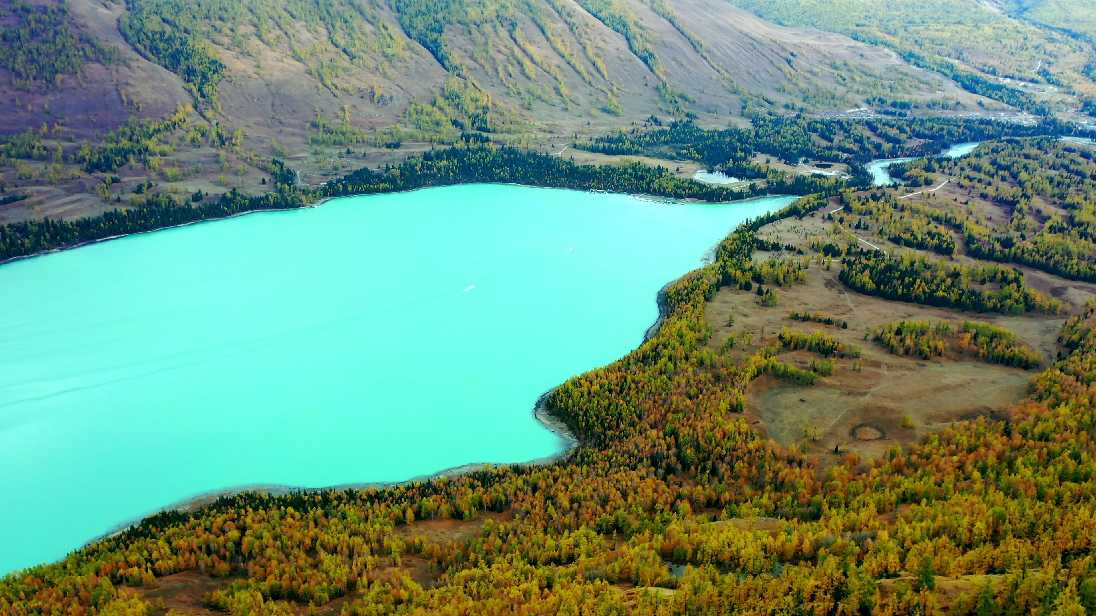
We get up early to watch the sunrise in the desert. After breakfast, we depart along the desert highway southbound and can arrange a visit to the Desert Husband and Wife Well if appropriate.
Driving Distance: 360 km
D4: Yutian – Hotan
After breakfast, we depart along the Kunlun Mountains, the desert Gobi Oasis, and the rose fields in Hotan Prefecture. Arriving in Hotan City, we visit the Rose Manor for a barbecue featuring authentic Hotan whole roasted sheep, baked stuffed buns, roast meat, yogurt, and rose tea.
Driving Distance: 180 km
D5: Hotan – Kashgar
After breakfast, we head west towards the ancient Silk Road city of Kashgar, which has a history of thousands of years. We have lunch in Yecheng, the starting point of the Xinjiang-Tibet Highway G219. We visit the zero-kilometer milestone of the Xinjiang-Tibet Highway together. In the afternoon, we enjoy the scenery of the Yarkant River Gobi Oasis farmland along the way.
Driving Distance: 450 km
D6: Kashgar One-Day Trip
After breakfast, we take a bus to the old town of Kashgar to watch the opening ceremony.
D7: Kashgar – Karakul Lake – Tashkurgan County
We depart early from Kashgar and follow the China-Pakistan Highway to Tashkurgan County. We admire the beautiful scenery of Baisha Mountain integrated with the lake at布伦口水库, take a walk by the Karakul Lake, and take a close look at the Three Peaks of Kunlun Mountains. With good luck, we can also see the reflections of the Three Peaks of Kunlun Mountains in the water. In the afternoon, we arrive in Tashkurgan County, visit the Stone City near the county town to learn about its history, and then walk to the Golden Grassland Wetland to enjoy the Stone City under the setting sun.
Driving Distance: 350 km
D8: Tajik Family Visit in Tashkurgan County — Kashgar
After breakfast, we visit a Tajik family in the county together.
Driving Distance: 350 km
D9: Kashgar — Aksu
After breakfast, we go together to Kashgar People’s Square to pay respects to the statue of Chairman Mao (built in 1969) and take a group photo.
Driving Distance: 450 km
D10: Aksu — Kuqa
After breakfast, we head to the Tianshan Tumur Peak Grand Canyon in Wensu: to admire the geological wonders of Danxia landform in western China.
Driving Distance: 320 km
D11: Kuqa Cultural and Natural Scenery One-Day Trip
After breakfast, we follow National Highway 217 on the Duku Highway to the Mysterious Grand Canyon of Tianshan Mountains, enjoying the unique red mountain landforms along the way. We have lunch in Kang Village beside National Highway 217.
Driving Distance: 200 km
D12: Kuqa — Urumqi
Departing from Kuqa in the morning, bidding farewell to southern Xinjiang and the Tarim Basin, we travel along the southern slope of the Tianshan Mountains and through Gobi oases on National Highway 314. Our thoughts still linger on the memories of the Tarim Basin in southern Xinjiang. In the afternoon, we cross the Tianshan Mountains and return to Urumqi, concluding our unforgettable journey in southern Xinjiang.
Driving Distance: 770 km
Xinjiang Tourism Consultation: (Same) 0991-8585456