
A 10-day in-depth tour of southern Xinjiang’s exotic scenery, including Atush Tianmen, Baisha Lake, Zepu Golden Poplar Forest, Desert Highway, Mysterious Tianshan Grand Canyon, and Lop Nur Village
For details, please contact: Xiao Guo: (same) 0991-8585456

Introduction to the Itinerary
D1: Gathering in Kashgar
Today, we will fly via Urumqi to Eshi for gathering. According to the text message notification from the team leader, we will check in at the designated hotel. After checking in, we are free to engage in activities. Friends who arrive early can go around Kashgar.
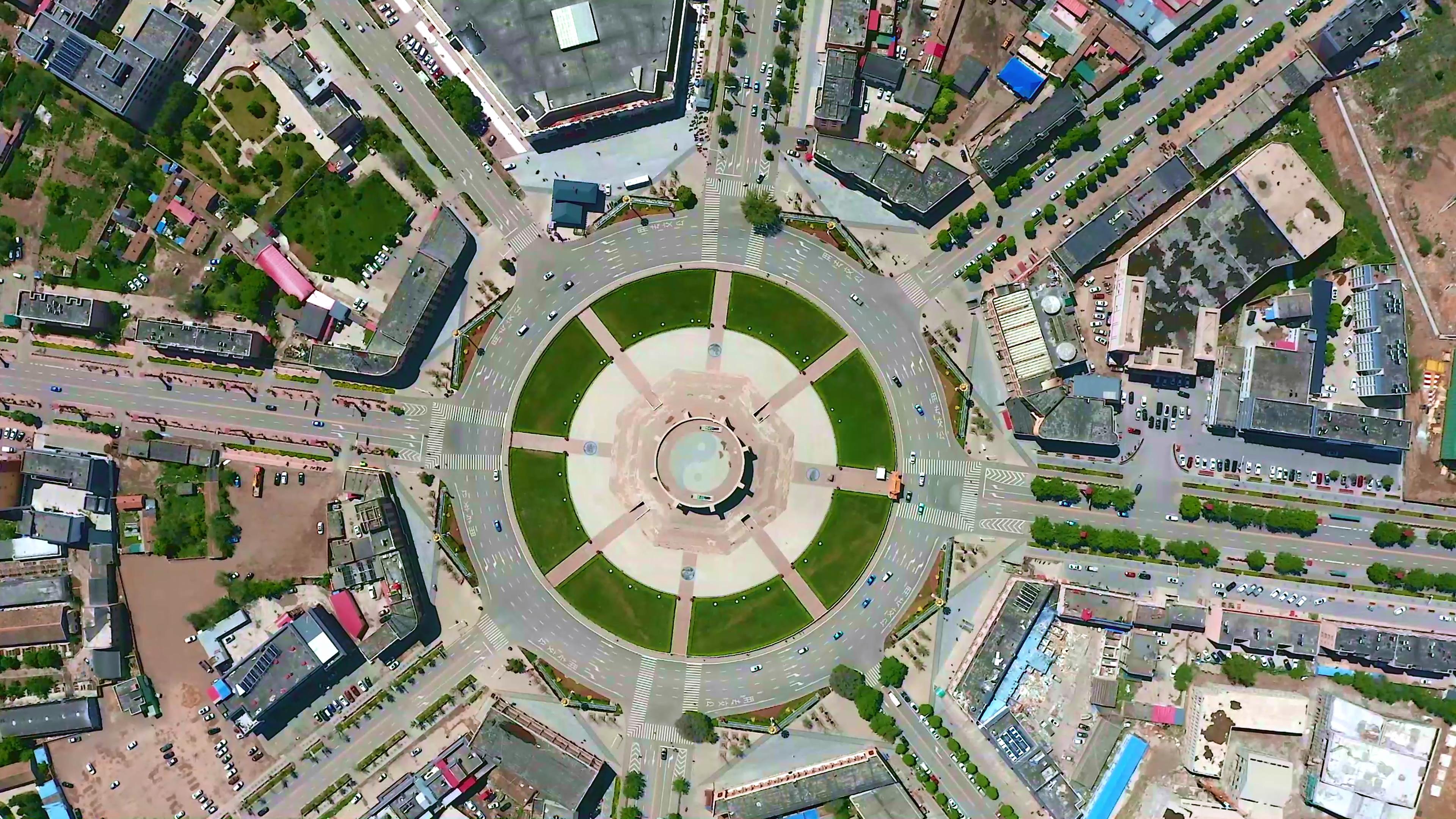
Kashgar City, belonging to the Kashgar Prefecture of Xinjiang Uyghur Autonomous Region, is located on the southwestern edge of Xinjiang, in the west of the Tarim Basin, bordering the Taklamakan Desert on the east, the Karakoram Mountains and the Ali Region of Tibet on the south, and the Pamir Plateau on the west. It is a border city in the westernmost part of China.
D2: Kashgar – Atush Tianmen – Kashgar Old Town – Grand Bazaar – Gaotai Residential Area – Kashgar
Today, we will spend the whole day exploring the old town of Kashgar. The old town of Kashgar is like a vivid picture of Uyghur folk customs in Xinjiang. The old town of Kashgar is located in the center of Kashgar, covering an area of 4.25 square kilometers and inhabited by about 126,800 residents. The streets and alleys in the old town are crisscrossed and laid out flexibly, with winding paths leading to secluded places. Most of the houses are made of earth, wood, and brick, and many traditional houses have a history of over a hundred years, forming a labyrinthine urban block. Atush Tianmen is an AA-level tourist attraction located in the southern branch of the Western Tianshan Mountains, in the west of Shangatush Town, Atush City, 75 kilometers away from Atush City. The Tianmen has a π-shaped opening, about 100 meters wide and over 500 meters high, with an immeasurable thickness. The scenic spot is magnificent, steep, deep, quiet, and mysterious. The surface of the stone wall resembles a variety of murals.
D3: Kashgar – Baisha Lake – Mushtagh Peak – Karakul Lake – Kashgar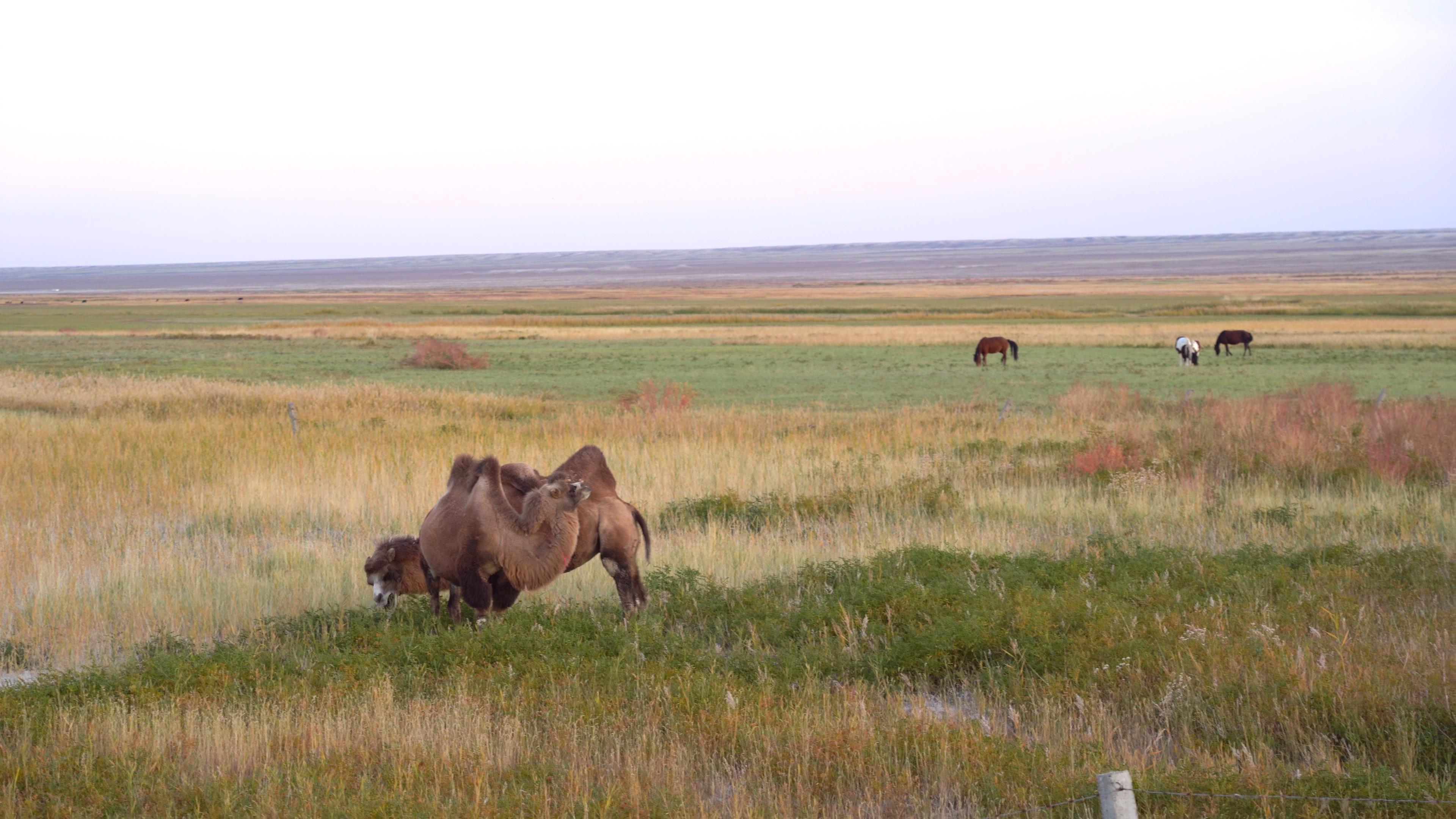
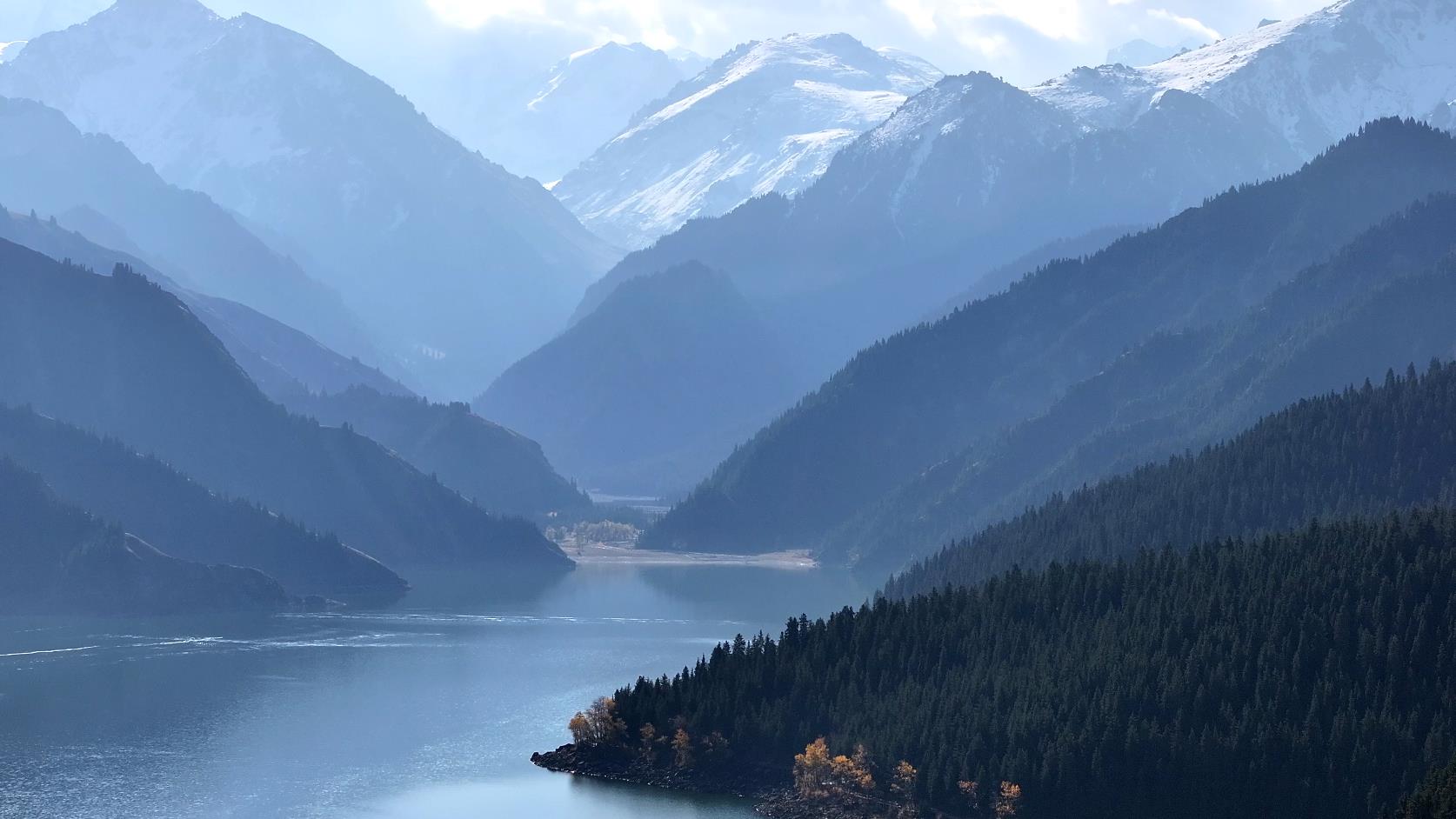
After breakfast, we will take a car to Karakul Lake, which is known as the "Black Lake". On the way, we can enjoy the rural scenery of Uyghur farms in southern Xinjiang and feel the leisurely life in the region north of the Great Wall in the depths of the desert. We can overlook the Aoyitake Hongshan Mountain, known as the "Flaming Mountain of Southern Xinjiang", and also take photos in front of the Baisha River, known as the Quicksand River, and the布伦口White Sand Mountain, which is the result of nature’s craftsmanship. Occasionally, we can also see ancient post stations of the Silk Road along the way. We will get a close-up view of the Mushtagh Snowy Peak, the father of glaciers with an altitude of 7546 meters, and Karakul Lake, a plateau lake with unpredictable colors. The reflection of Mushtagh Peak, the father of glaciers, on the surface of Karakul Lake, and the magnificent appearance of Kongur Tagh Mountain with an altitude of 7719 meters. Herdsmen drive yak herds, and you can also ride horses or camels at your own expense for photos. We will return to Kashgar at a suitable time to check in and rest.
D4: Kashi – Zepu Golden Huyang Forest – Yarkand
After breakfast, we head to the Zepu Golden Huyang Forest. Golden Huyang National Forest Park is located 36 kilometers southwest of Zepu County within the Yasidun Forest Farm, situated on the upper edge of the Yarkand River alluvial fan. The scenic area covers an area of 40,000 mu, with a natural Huyang forest area of up to 20,000 mu. In the distance, the majestic Kunlun Mountains stand tall, while the tributaries of the Yarkand River flow endlessly beneath our feet, passing through the park. The snowy Kunlun Mountains and the Yarkand River have jointly nurtured this magical land. Golden Huyang National Forest Park boasts diverse vegetation types, with 489 hectares of continuous natural forests and a forest coverage rate of 76%. There are 51 species of plants belonging to 39 genera and 27 families, including a large number of medicinal plants such as licorice, seabuckthorn, wolfberry, dodder, ephedra, and mandrake. Red willow and the precious medicinal herb Cistanche deserticola, known as the "ginseng of the desert" and attached to the red willow, can be seen everywhere, as well as delicious Huyang mushrooms.
D5: Yarkand – Kashi Yulong River Jade Picking – Hetian
After breakfast, we head to Kashi’s Yutian River to pick up jade, and then arrive in Hetian City, where the rich Uyghur culture is evident. Hetian jade, handmade carpets, Aidelais silk bazaar market, piles of fiery red pomegranates, sweet grapes and melons, uniquely fragrant charcoal-roasted eggs, unforgettable naan-pit roasted pumpkins, and beautiful Hetian Uyghur girls all make people reluctant to leave. Afterward, we visit the Yulongkashi River. The Yulongkashi River and the Karakash River originate from the Kunlun Mountains and converge in the desert to form the Hetian River, which eventually flows north into the Tarim River. In the evening, Hetian’s night market stalls are absolutely not to be missed.
D6: Hetian – Desert Highway – Aksu
After breakfast, we leave Hetian and travel to Aksu by car. Heading south, we ride on the world’s longest desert highway, crossing the world’s second-largest desert, the Taklamakan Desert, known as the "Sea of Death". The miraculous desert highway stretches across the vast desert, with dunes, desert, diversiform胡杨 trees, tamarisks, and red willows, all of which are breathtaking. Arriving in Aksu City, we are greeted by its rich Uyghur culture. Aksu has a pleasant climate, flat terrain, fertile land, abundant water sources, sufficient sunshine, and a long frost-free period, making it suitable for the growth of various crops. The city has 780,000 mu of cultivated land, 700,000 mu of forest area, and 4,030,000 mu of grassland, allowing for grazing throughout the year. It is an important national base for commodity grain and cotton. Its specialty products such as red dates, thin-skinned walnuts, Red Fuji apples, apricots, fragrant pears, grapes, and melons enjoy a high reputation both domestically and internationally, making it famous as the hometown of melons and fruits.
D7: Aksu – Mysterious Grand Canyon of Tianshan – Kuqa
After breakfast, we head to Kuqa Grand Canyon, one of China’s most beautiful canyons and a national geological park. This canyon is truly a wonder of the world. The Mysterious Grand Canyon of Tianshan is located in the Kiziliya Mountains at the southern foot of the Tianshan Mountains. With red mountain bodies, towering peaks, steep slopes, and long, narrow canyons that widen into plazas and narrow to the point where one can only pass sideways, the canyon winds and turns, echoing with sound. Climbing to the top of the mountain, you can fully appreciate the charm of being "mystical, magical, majestic, ancient, and serene" all in one. Afterward, we drive to Kuqa for accommodation.
Kuqa Grand Canyon is located at the southern foot of the Tianshan Mountains, 80 kilometers north of Kuqa County. In Uyghur, it is called ‘Kezilya’, meaning ‘red cliff’. It has an altitude of over 2800 meters and runs east-west. It is a 50-meter-deep and 5-kilometer-long ground fissure formed by the melting water of the Tianshan Mountains. It is known as the ‘Mysterious Grand Canyon’ and ‘Devil Canyon’. Kuqa Grand Canyon is one of the ten most beautiful canyons in China and has been listed as a national geological park.
D8: Kuqa – Tarim Populus euphratica Forest – Korla
After breakfast, we will proceed to the Tarim Populus euphratica Forest. The Tarim Populus euphratica Forest National Forest Park covers a total area of 100 square kilometers and is located 70 kilometers away from the southern desert highway of Luntai County in the middle reaches of the Tarim River on the northeastern edge of the Taklamakan Desert. It is the largest primitive Populus euphratica forest park in Xinjiang and also the most concentrated area of primitive Populus euphratica forests in the entire Tarim River basin. The Tarim Populus euphratica Forest National Forest Park integrates the natural landscapes of the Tarim River, Populus euphratica forests, and deserts. It is the oldest, largest, most preserved, and most primitive Populus euphratica forest reserve in the world. Populus euphratica is a residual ancient species from the third century AD. It is a plant transformed due to desertification. Its rarity is comparable to that of ginkgo. It has strong vitality and is known as a living fossil.
D9: Korla – Lop Nur Village – Heshuo
After breakfast, we will proceed to the Lop Nur Village, which covers an area of 72 square kilometers and has over 20 households, making it one of the largest villages in western China. It belongs to Qiongkule Pasture and is a secluded paradise inhabited by Lop people. The road to the village is built on the Gobi Desert, giving a sense of ‘desolation’. Upon reaching the entrance of the village, there is no trace of the bustling and noisy city life. The gateway is made of wood as a whole and is also known as the ‘Gateway of Longevity’. The design of the gateway has its own story. Inside the village, there are houses built with wood or straw. The houses are not clustered together but scattered around. Around the houses, there are wooden horses, swings, and other toys left by Lop children, which are the most primitive toys. The structures of the houses are also completely different, giving people a casual feeling. Afterwards, we will proceed to Heshuo for accommodation.
D10: Heshuo – Strange Stone Forest – Urumqi
After the meal, we will depart for Urumqi; on the way, we will pass by the first unique mountain in Xinjiang, Toksun Pangjier Strange Stone Forest, which is such an extraordinary mountain. Its beauty and uniqueness will be etched in the minds of those who have seen it, making it unforgettable. The Pangjier Strange Stone Forest is scattered on the ridges and slopes of the Pangjiertage Mountain, with an average altitude of 1200 meters and a total area of about 1 square kilometer. The stone forest is 55 kilometers southeast of Toksun County and 10 kilometers from Kerjian Town. The stone forest is a peak forest landform formed by dissolution and wind erosion, known as ‘Pangjiertage’, which means ‘a mountain like a porous window’ in Uyghur.
Today is also the end of our trip,
For details, please contact: Xiao Guo: (same) 0991-8585456