
Winter in Xinjiang is less noisy.
Quietness fills everywhere.
The beauty of Xinjiang in winter can only be known by those who have been there.
You will definitely not regret it.
Xinjiang Tourism Consultation Hotline: (Same as above)
Hemu
It can be as warm as a fairy tale
▼
It can also be as elegant as an ink painting
▼
When you are tired of the hustle and bustle of the world
Maybe what is needed
Just in a beautiful little village
Drinking milk tea in large gulps
Watching the sunset
▼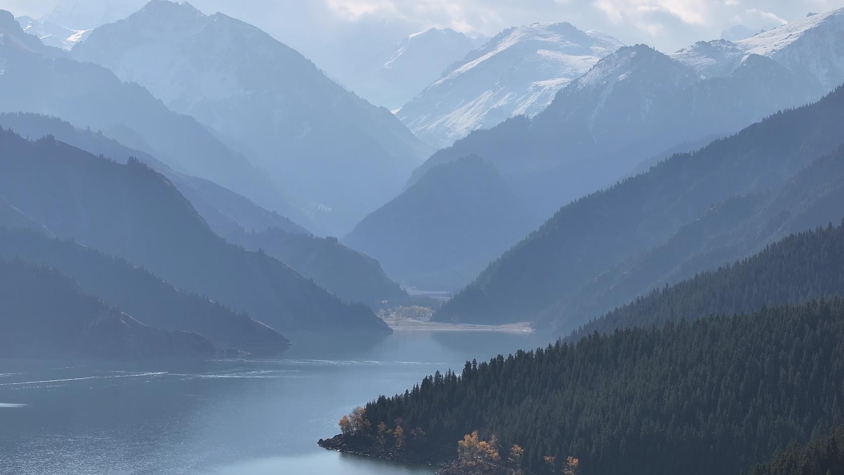

Hemu Village, located in the northwest border region of the Altay Mountains in Xinjiang, is 165 kilometers away from Burqin County. This idyllic little mountain village sits on a flat land surrounded by mountains, with rows of Populus euphratica and Birch trees surrounding the village. On the hills around Hemu Village, one can overlook the panoramic view of the village and the Hemu River: a lonely valley, a small bridge over flowing water, and horsemen raising dust as they ride through the forest.
Tomur Glacier at the peak of Mount Tianshan
Tomur Peak at the peak of Mount Tianshan
Bathed in the setting sun, the white snow turns golden yellow
▼
The winding glacier at the foot of Tomur Peak
▼
Snow-capped mountains and glaciers
A roll of blue painting
▼
Tomur Glacier at the peak of Mount Tianshan: Tomur Peak, with an altitude of 7443.8 meters, is the highest peak of Mount Tianshan. Located in Wensu County in the west of Mount Tianshan, Tomur Peak is the main peak of the Tianshan Mountains and is listed as a national comprehensive nature reserve. Areas above 4000 meters are a world of ice and snow, with jade-like dragons flying and a cold atmosphere pervading even in the hot summer. The Khantengri Glacier in the north of Tomur Peak is one of the eight major valley glaciers in the world and is known as the world’s number one glacier.
Winter in Kumtag Desert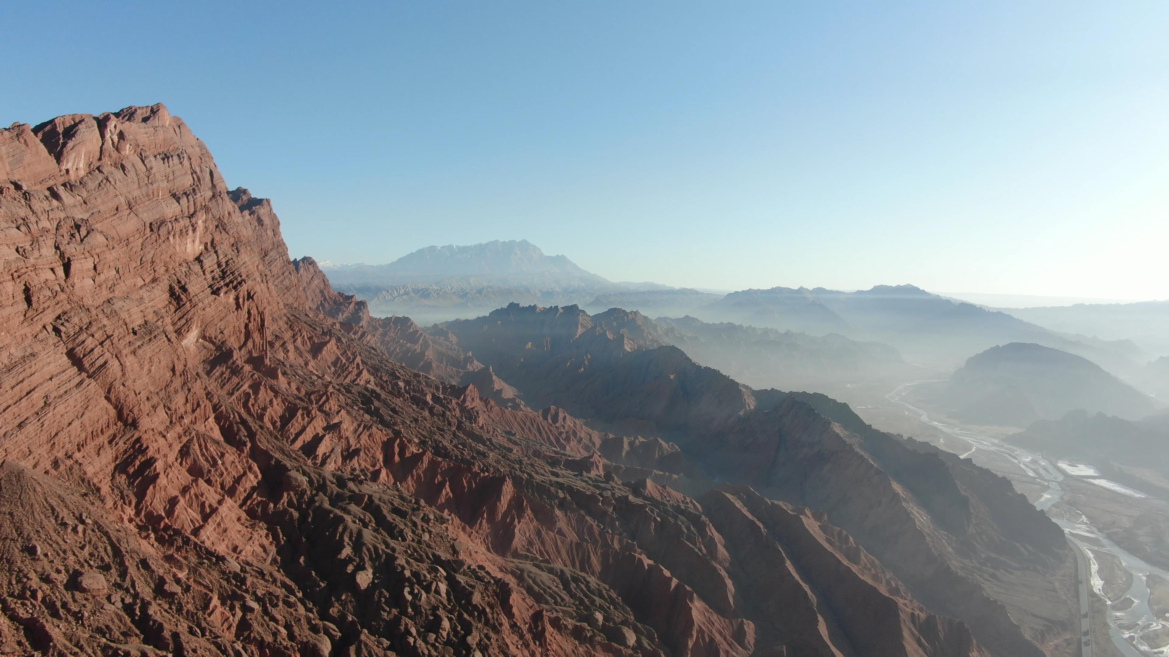
In winter, the desert becomes a magical place
▼
Extreme heat turns into a world of ice and snow
▼
▼
Kumtag is located in the northeast of Ruoqiang County, Bayingolin Mongolian Autonomous Prefecture, southeastern Xinjiang Uyghur Autonomous Region, between Lop Nur to the east and Yuguan Pass in Gansu Province to the west. With an area of 22,800 square kilometers, it is an extremely arid climate zone with various unique desert landscapes.
Altay
The name Altay means "golden mountain and silver water"
▼
The air quality is the best in Xinjiang
▼
In winter, local herdsmen often travel by horse-drawn sledges
▼
Altay: The ice and snow resources of the six counties and one city in the Altay region are uniquely endowed by nature in Xinjiang. With abundant snowfall, long snow seasons, high-quality snow, and suitable altitudes and temperatures, it is truly the "earliest origin of human skiing" and "the most beautiful snow village in China", and has gradually become a winter tourist destination.
Tianchi
Tianchi was anciently known as "Yaochi"
▼
Legend has it that more than 3,000 years ago
King Mu once held a joyful feast and sang duets with the Queen Mother of the West by the side of Tianchi
Leaving a timeless story behind
Standing by the edge of Tianchi and looking up at the sky
It seems one can still feel it
The time when King Mu and the Queen Mother of the West toasted each other
▼
Tianshan Tianchi, anciently known as "Yaochi", is a natural scenic area centered around a high-altitude lake. It is located in Fukang City, Changji Hui Autonomous Prefecture, Xinjiang Uyghur Autonomous Region. In 2007, Tianshan Tianchi was rated as a National 5A-level tourist attraction by the China National Tourism Administration.
Sayram Lake
The scenery here is magical and beautiful
▼
Like a dazzling sapphire hanging high in the rift basin between the Western Tianshan Mountains
▼
This is a place where one can forget all their worries
▼
Sayram Lake, anciently known as "Jinghai", is located in the Northern Tianshan Mountains in Bole City, Bortala Mongolian Autonomous Prefecture, Xinjiang. Its appearance resembles a sapphire. The lake area was formed during the Himalayan orogeny 70 million years ago and is geologically known as a "rift lake".
Scenery of Gongnais National Forest Park
Blue sky and white clouds
▼
Rime
▼
Snow-covered
▼
Gongnais Forest Park is located in Hejing County, Bayingolin Mongolian Autonomous Prefecture, Xinjiang. It sits upstream of the Gongnais River and is the location of the Gongnais Forest Farm. The altitude here ranges from 1,600 meters to 2,400 meters. Snow-capped mountains are reflected in lakes, and pine trees and wildflowers cover the mountains. On the hills are flocks of white sheep.
Baihaba
Baihaba is known as the First Village in the Northwest
▼
Located on the border
▼
The scenery here is beautiful and the customs are simple and honest
▼
Baihaba Village (Baihaba Scenic Area) is known as the First Village in the Northwest and the First Post in the Northwest. It is located in Tiereketi Township, Habahe County, Altay Prefecture, Xinjiang, on the border. All buildings in Baihaba Village are made of wood, making it a typical European-style village.
Pamir Plateau
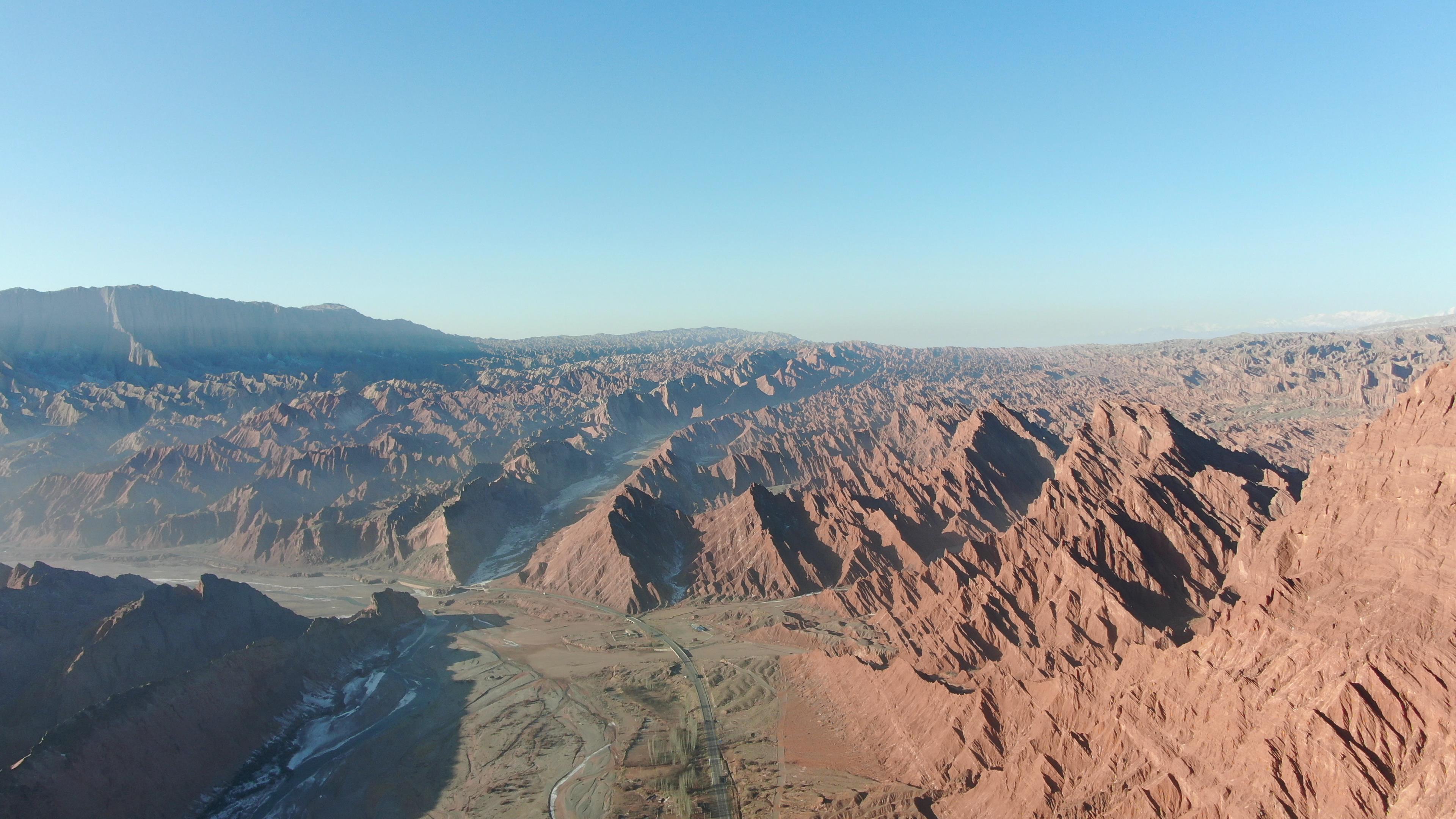
Mountains rise and fall, stretching far and wide
▼
Snow-capped peaks stand tall, reaching into the clouds
▼
In this place, heaven is within reach
▼
"Pamir" means "Roof of the World" in Tajik. The plateau is at an altitude of 4,000 meters to 7,700 meters and boasts many peaks. Among them, the highest peak of the Pamir Plateau is K2 (Qogori Peak) in the Karakoram Mountains, with an altitude of 8,611 meters, making it the second highest peak in the world.
Xinjiang Tourism Consultation Hotline: (Same as above)